Updated 2026
Back in 2021 our local Pub, the Who’d Have Thought It, St. Dominick, had the great idea of providing a BLOG for the parish (the village and the parish have the same name!) They then asked for contributors – and yours truly offered to write up an occasional series on the History of St. Dominick – as I have gathered a huge amount of information over the years.
Though aware that my blog is read all over the world {NOTE 2026 – I have now lost ALL these readers from all over the world due to a technical hitch – you may sign up at the top of the site – over on the right} I have decided to re-post these blog-posts here too. St. Dominick is ‘home’ and St. Dominica (the patron saint of the church – and therefore namesake of the parish) is my inspiration for the book I am researching and writing at the moment.
So – welcome to our little corner of Cornwall, and I hope you enjoy this diversion into its history.
When we moved into Radland in 1983 I was determined to find out the history of that old house – and that also led me into glimpses of the history of St. Dominick itself. However, it was the inspiration of The Parish Map Project (a Common Ground initiative) that led me to work with about forty people within the parish, with many doing the research, artists creating the illustrations and others providing services, like photocopying, all to create a series of maps illustrating the history of the parish.

If you were not involved, a little about the Project. Parish Maps could be of any material, design, interest-focus or scope. We decided to take five snap-shots-in-time – and base most of them on existing maps. Many households in the parish have a copy, and there is a large-size set hanging in the Parish Hall.
As there were no actual maps of the area until the sixteen hundreds, so the first map was dated at 1485 – showing everything we found from pre-history to that time. This date was chosen as it is also the start of the Tudor period. It is acknowledged that the relative stability of the Tudor period accelerated change in all parts of the country, making this point a good place to pause and look back.
The second map was dated 1748, and was based on an existing map you can view if you go to St. Michael’s Mount – drawn by Thomas Martyn. (Note 2026: there used to be a copy at Lanhydrock, but it is now not available to view) To this was added the research that was gathered that focussed on properties that had been built and were still there between 1485 and the map’s date.
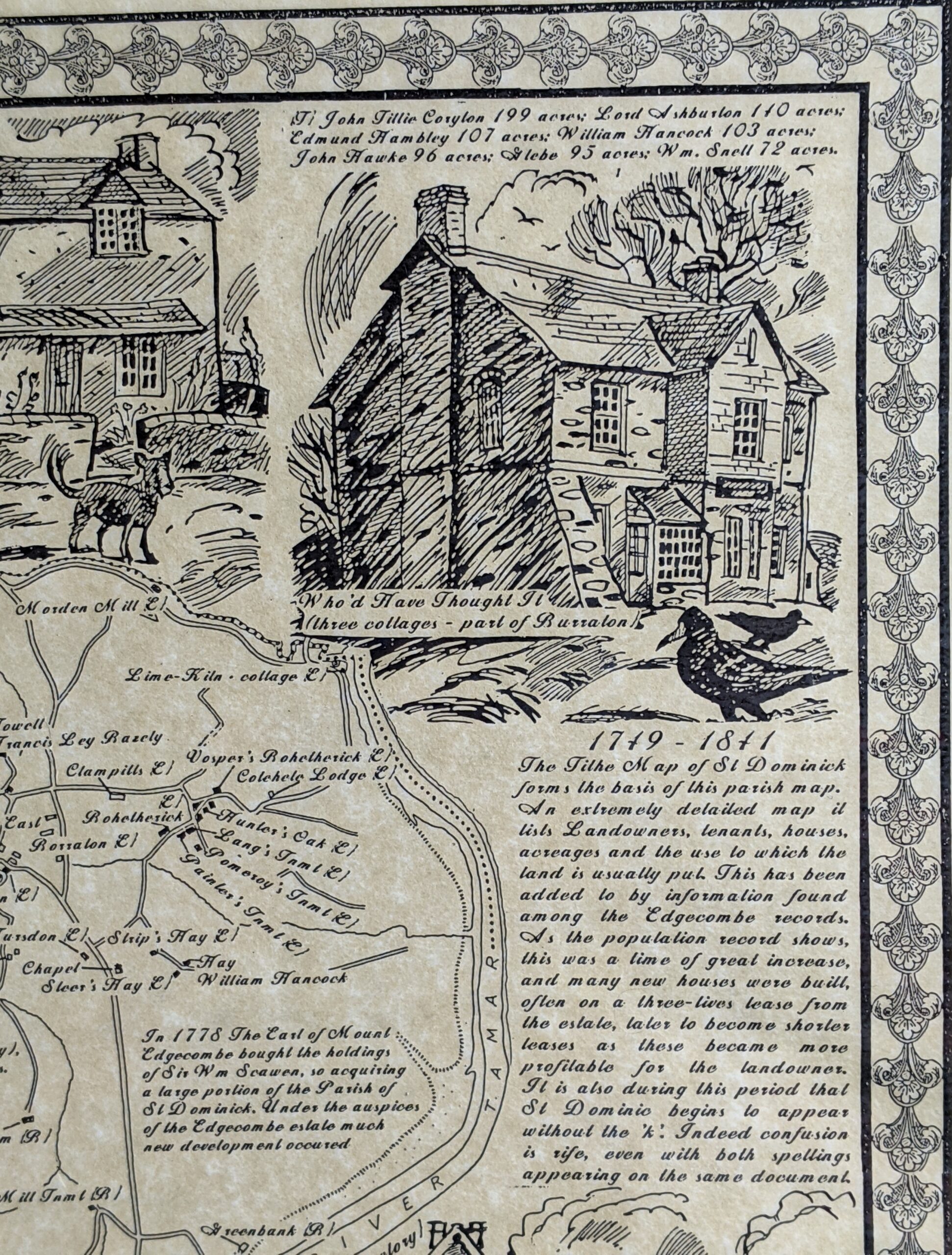
The third map is based on the Tithe Map 1841, probably the most detailed map made of the area – ever! A tithe map was made to commute tithes-in-kind (for example: one stook of wheat in every10 harvested) into a monetary value – so they could be paid that way instead. The original tithe map is huge – and barely any of the fine detail could be shown on our maps, but the basic information and everything discovered was added to the original map.
The fourth map was based on the 1951 ordnance survey map – and shows how life had changed dramatically over the previous 110 years – and brings us firmly into history as remembered by people born in St. Dominick.
The final map was set at the year we completed the project,1995, and yet, even in this short time-period since then the changes are dramatic to see in terms of housing development and change of use for other buildings.
In this occasional series I hope to share with you the research and the sources (where possible) and describe this area as it developed from just an area bordered by streams and the river, into the parish we know today. I do hope you’ll join me for the journey – Ann
Do you like local history?
What aspects interest you most?
Have you taken part in any history projects where you live?
love to hear from you 🙂 Xx Ann
ps If you are reading this on email and would like to comment just click onto the title and it will take you to the actual blog – so you can comment there.
If it is the first time you have written a comment don’t worry if it doesn’t appear immediately, your first comment has to be verified (to keep the spam-bots out) and I do this personally – so I am sure to see your comment – thanks for reading – Ann
Remember – reviews of books are a great way to say ‘thank you’ to an author if you like what they write,
Thank You






Hi Ann
Question? is this map a local thing or wider, hadn’t heard about it
Hi Ian,
Nice to hear from you!
Other Parish Map Projects were done locally too – Calstock Parish did one, I am sure you have seen. (I have a copy in a folder – A1 size in colour – just one picture with all sorts of details of local interest on it)
In St. Dominick we decided on a ‘Five Snap-shots in Time’ approach – and tried to include historic landmark features (houses, churches etc) and social factors (ownership, trades, etc) as well as ‘what people valued about the parish’ (last map only). These were then reproduced in A3 size sets with a little explanatory booklet about the project – which many bought – the profit going to the Hall.
When this covid crisis is settled down – I can let you see a set if you like?
thanks for the comment
X Ann
Hi Ann I spent the first 3 years of my life in St Dominick, we lived in the terrace of cottages with the monkey puzzle tree 1969 to 1973. I’m not keen on posting publicly. But would love to have more of a conversation. My dad was a daffodil farmer in the valley
Hi Georgina,
Nice to hear you are interested in the history of St Dominick.
Sure, we can email off the blog, please email me at: ann @ annfoweraker.com ( closing up the gaps when you put it in ..it is written that way to confuse the bots) I’ll reply from my personal email.
Hope this helps,
Xx Ann